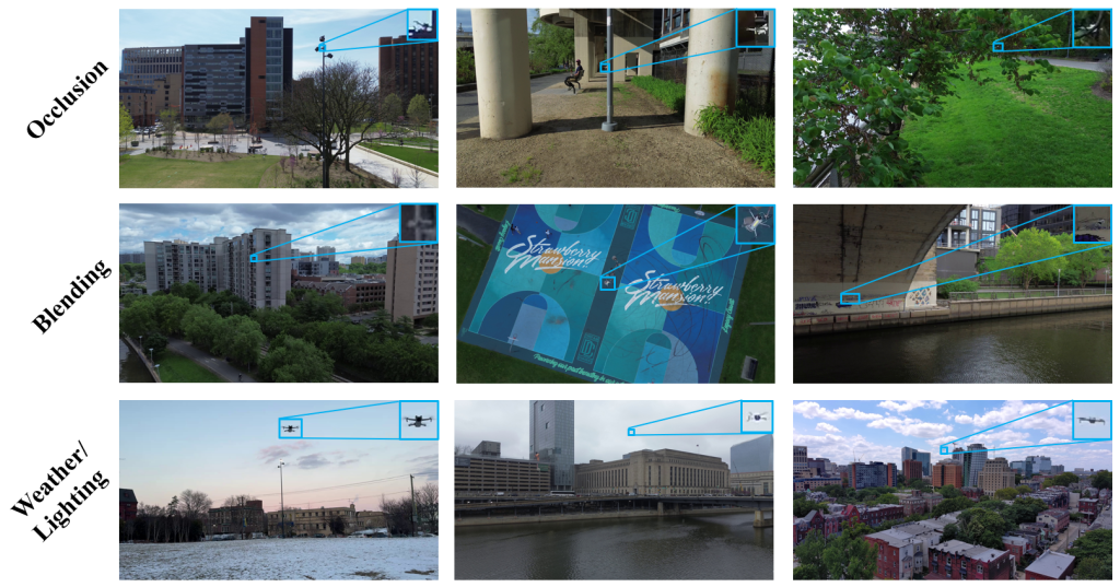
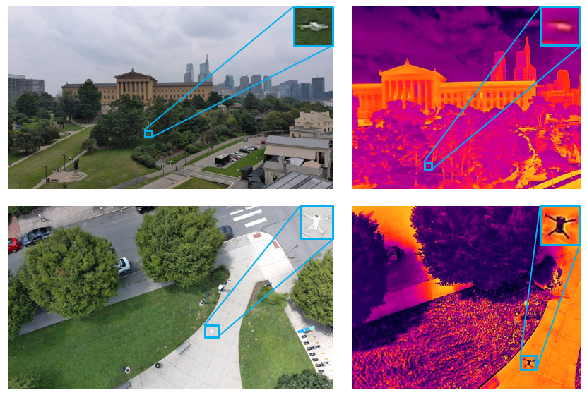
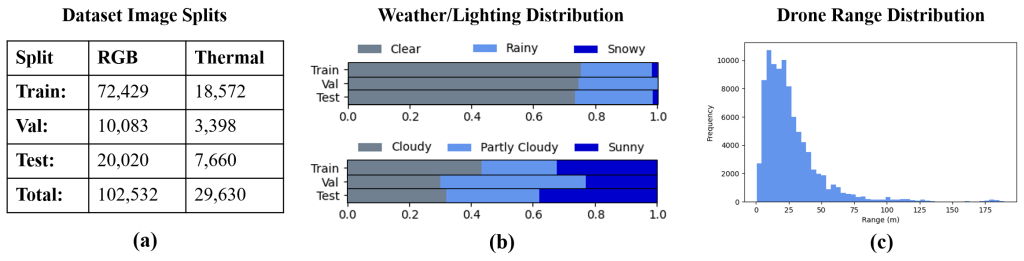
Unmanned Aerial Vehicles (UAVs) have quickly become common in various airspaces, representing a wide range of applications from recreation flying to commercial photography and package delivery. With the increasing prevalence of UAVs, it becomes critical that both manned and unmanned aircraft can detect UAVs and other flying objects from long range to effectively track movement and ensure safe operation in shared spaces. While several datasets have been introduced for drone detection, the need for expanded high-quality data persists, especially in the area of high-resolution long-range drone data. To address this, we introduce a high-resolution dataset of 102,532 long-range RGB images of drones, sampled at 5 FPS from 128 distinct video clips taken mid flight during 17 different data collection days spread over 8 months to ensure a wide variety of lighting scenarios, flight locations, and background elements. The dataset boasts comprehensive drone range information across the dataset, as well as 29,630 IR images, all paired with RGB counterparts from the base dataset. As one of the first drone detection datasets to leverage 4k image resolution and paired 640×512 IR images, our work represents a significant advancement to enable the detection of drones at long range.
Dataset Access
Coming soon!
If you find this dataset useful in your work, please consider citing the dataset paper:
@INPROCEEDINGS{peterson2026_LRDDv3,
  author={Peterson, Knut and Mayers, Zaid and Yousuf, Azmain and Chowdhury, Priontu and Zaczepinski, Asher and Arezoomandan, Solmaz and Maarefdoust, Reihaneh and Han, David},
  booktitle={2026 IEEE International Conference on Robotics and Automation (ICRA)},
  title={LRDDv3: High-Resolution Long-Range Drone Detection Dataset with Range Information and Thermal Data},
  year={2026},
  volume={},
  number={},
  pages={1-8},
  doi={TBD}
}